Crop Yield Mapping using Remote Sensing
In the modern agricultural landscape, precision agriculture plays a pivotal role in optimizing resource use and enhancing productivity. Crop yield mapping through remote sensing technology is one of the most advanced techniques that can be employed to achieve these goals. This service leverages satellite imagery and aerial photography to monitor crop health, growth stages, and overall yield potential.
Remote sensing technology captures data from satellites or aircraft at various wavelengths, including visible light, infrared, and microwave radiation. By analyzing this data, we can identify patterns that indicate differences in plant physiology, such as water content, chlorophyll levels, and other biophysical characteristics. These insights are crucial for understanding the health of crops throughout their lifecycle.
The process begins with thorough preparation of the area to be monitored. This includes ensuring clear weather conditions for optimal image capture and delineating areas of interest. Once captured, images undergo rigorous processing using specialized software that enhances contrast, corrects distortions, and extracts relevant spectral information. From here, algorithms are applied to interpret the data, generating detailed maps that highlight variations in crop vigor and yield.
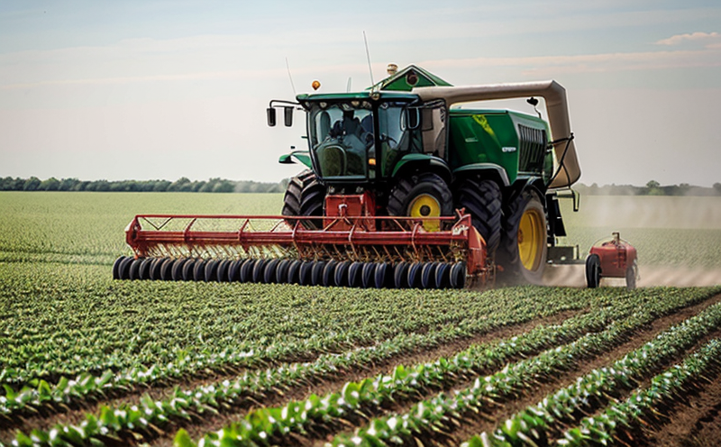
This service is particularly advantageous for large-scale farms or areas where traditional field visits would be impractical. It allows farmers and agricultural managers to make informed decisions about resource allocation, such as irrigation, fertilization, and pest management. By identifying stressed or underperforming sections of a field early on, corrective actions can be taken before significant losses occur.
Furthermore, this method provides valuable long-term datasets that are essential for trend analysis. Over successive seasons, the data collected helps in understanding how climate change impacts crops, optimizing future planting schedules, and improving overall resilience against adverse conditions.
Benefits
- Improved Decision Making: Enhanced ability to make informed decisions regarding resource allocation and management practices.
- Increased Efficiency: Reduced need for ground-based sampling, leading to time savings and lower costs.
- Precise Resource Application: Targeted application of water, fertilizers, and pesticides only where needed, minimizing waste and environmental impact.
- Early Detection: Identification of stressed or diseased areas allowing for timely intervention to prevent further damage.
Why Choose This Test
Selecting crop yield mapping via remote sensing offers several compelling advantages over traditional methods. One of the key benefits is its ability to cover vast areas quickly and efficiently, which is particularly beneficial for large-scale operations. Unlike ground-based sampling that can be labor-intensive and costly, remote sensing provides a comprehensive overview at a fraction of the cost.
Moreover, this method allows for continuous monitoring throughout the growing season rather than relying on periodic field visits. This continuous data stream enables real-time adjustments to agricultural practices based on current crop conditions. Additionally, it supports compliance with regulatory requirements by providing accurate documentation and supporting evidence for decision-making processes.
The accuracy of remote sensing technology is further enhanced through integration with other geospatial tools like Geographic Information Systems (GIS) software. This allows for spatial analysis that can help in identifying specific patterns or trends within the data, which might not be apparent otherwise. The use of international standards such as ISO 19152 and ISO 19678 ensures reliability and consistency across different systems.
For quality managers and compliance officers, this service provides robust evidence for meeting sustainability goals while also aiding in the optimization of resource utilization. It supports continuous improvement initiatives by offering insights into where improvements are needed most.
Use Cases and Application Examples
| Use Case | Description |
|---|---|
| Farm Management | Identify areas of stress or underperformance in large fields, enabling targeted interventions. |
| Precision Agriculture | Optimize irrigation and fertilizer application based on real-time data. |
| Crop Insurance Claims | Provide clear evidence of crop health status during claims assessment. |
| Climate Change Impact Analysis | Analyze changes in crop yields over time to understand climate impacts. |
| Pest and Disease Monitoring | Detect early signs of pest infestation or disease outbreaks for prompt action. |
| Water Management | Monitor soil moisture levels to plan efficient water use strategies. |
| Regulatory Compliance | Document compliance with environmental regulations and best management practices. |