Soil Erosion Monitoring
In agriculture and forestry, soil erosion is a critical issue that can lead to significant environmental degradation and economic losses. Understanding and monitoring this phenomenon is essential for maintaining healthy ecosystems and optimizing agricultural productivity.
The process of soil erosion involves the detachment, transport, and deposition of soil particles by wind or water. Soil erosion has profound impacts on both terrestrial and aquatic ecosystems. In agriculture, it can lead to reduced crop yields, increased costs associated with land restoration, and diminished soil fertility. In forestry, it can disrupt nutrient cycling and forest health.
Monitoring soil erosion is vital for implementing sustainable practices that protect natural resources and promote ecosystem resilience. This service leverages advanced technologies and methodologies to assess the extent of soil erosion in agricultural fields and forest ecosystems.
The monitoring process involves several key steps: initial site assessment, data collection using appropriate instruments, analysis of collected data, and interpretation of results. The goal is to provide actionable insights that can guide land management decisions aimed at reducing soil loss and enhancing environmental sustainability.
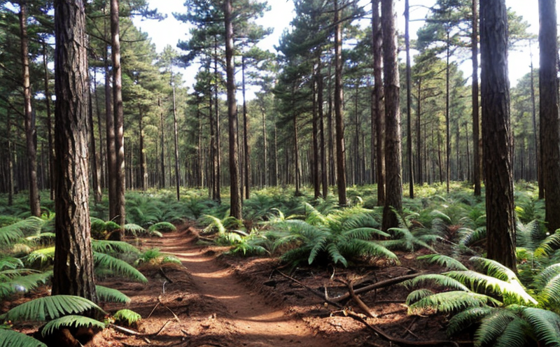
For agricultural fields, the focus is on identifying areas prone to erosion due to improper tillage practices or steep slopes. For forest ecosystems, monitoring targets disturbances caused by natural events such as windstorms or human activities like logging.
The service employs a multidisciplinary approach combining soil science, hydrology, and geography to ensure accurate assessments. By using advanced remote sensing techniques, field sampling, and statistical modeling, we can accurately quantify erosion rates and predict future trends.
Our team of experts utilizes state-of-the-art equipment including LiDAR scanners for topographical mapping, GPS devices for precise location tracking, and soil moisture meters for assessing water infiltration rates. These tools provide comprehensive data necessary for understanding the dynamics of soil erosion processes.
The insights gained from this monitoring are invaluable for developing targeted mitigation strategies tailored to specific conditions on each site. Whether it's implementing contour farming techniques in agriculture or reforestation efforts in forestry, our expertise helps create lasting solutions that benefit both current and future generations.
Applied Standards
| Standard Name | Description |
|---|---|
| ISO 14653:2017 | Guidelines for soil surveying in agriculture. |
| ASTM D6892-04(2016) | Standard practice for estimating soil erosion rates using the Modified Universal Soil Loss Equation (MUSSLE). |
| Standard Name | Description |
|---|---|
| EN 1978:2006 | Guidance on assessing soil erosion risk in forested areas. |
| IEC 62534-1:2012 | Standard for environmental monitoring systems including those used for measuring soil loss. |
Scope and Methodology
| Type of Equipment | Purpose |
|---|---|
| LIDAR Scanner | To generate high-resolution digital elevation models (DEMs). |
| GPS Device | To track the exact locations where soil samples are collected. |
| Soil Moisture Meter | To measure water content in different layers of soil. |
The methodology for monitoring soil erosion involves several stages:
- Site Selection: Identifying locations within agricultural fields or forested areas suspected to be at higher risk for erosion.
- Data Collection: Gathering physical samples of topsoil and using the aforementioned equipment to gather additional data points such as slope angle, vegetation cover, etc.
- Analyzing Samples: Conducting laboratory analysis on collected soil samples to determine nutrient levels and other relevant parameters.
- Data Interpretation: Analyzing all gathered data to identify patterns indicative of erosion.
The results from these analyses help us provide recommendations for interventions designed to prevent further degradation. These may include changes in farming practices, reforestation efforts, or establishment of buffer strips around waterways.
Benefits
Implementing soil erosion monitoring services can yield numerous benefits across various sectors:
- Environmental Protection: By identifying hotspots early on, we enable proactive measures to protect biodiversity and maintain ecological balance.
- Economic Savings: Preventative actions reduce the need for costly remediation projects later down the line. Farmers can avoid losses due to reduced yields while foresters see improved timber quality.
- Sustainable Land Use: Encouraging sustainable practices ensures long-term viability of agricultural lands and forested areas, supporting future generations.
- Informed Decision Making: Providing clear evidence-based information allows stakeholders to make informed choices about resource allocation and policy formulation.
With our comprehensive approach to monitoring soil erosion, organizations can ensure they are adhering to best practices while contributing positively towards global sustainability goals.