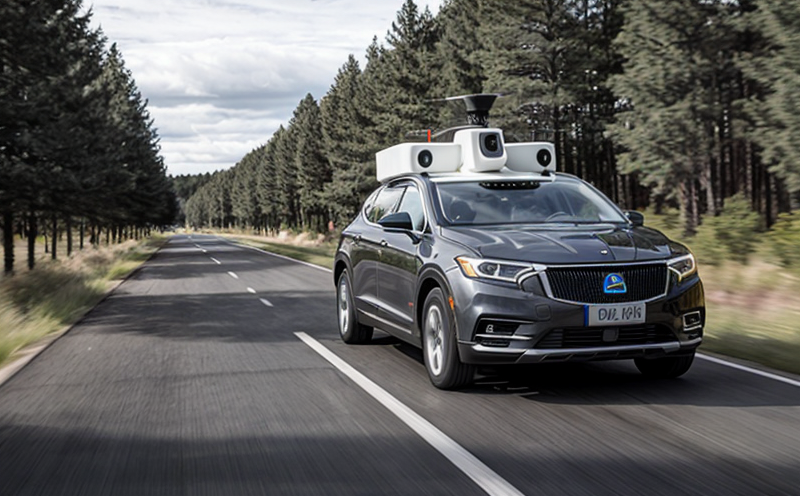
ISO 34510 LiDAR-Based Navigation Accuracy Assessment
The ISO 34510 standard provides a framework for the testing and assessment of navigation accuracy in autonomous systems utilizing LiDAR technology. This service focuses on evaluating the precision, reliability, and robustness of autonomous navigation systems based on LiDAR data. The standard is crucial as it ensures that autonomous vehicles can operate safely and effectively within various environments.
LiDAR (Light Detection And Ranging) sensors are critical for autonomous navigation because they provide high-resolution 3D maps of the surrounding environment using laser pulses. These systems require rigorous testing to ensure their accuracy, especially in dynamic or cluttered environments where a slight error can lead to dangerous situations. The ISO 34510 standard helps verify that these systems meet safety and performance requirements.
The testing protocol involves several steps including initial system configuration, environmental setup, data collection, processing, and final assessment. Each step is meticulously planned and executed to ensure accurate results. The process begins with the selection of appropriate test environments that mimic real-world conditions as closely as possible. This includes urban, rural, and industrial settings.
Once the environment is set up, the LiDAR system is calibrated according to ISO 34510 specifications. Calibration ensures consistent performance across multiple tests and different operational conditions. After calibration, the actual navigation accuracy testing begins. This involves moving a test vehicle or robot through predetermined paths while recording data using LiDAR sensors. The recorded data is then processed to determine discrepancies between the expected path and the actual path taken by the autonomous system.
The results of this assessment are critical for quality assurance and compliance with regulatory standards. They provide insights into potential areas where improvements can be made, ensuring that the system meets not only current but also future safety and performance requirements. This service is invaluable for R&D engineers who are continually looking to enhance their autonomous navigation systems.
By adhering to ISO 34510 guidelines, we ensure that our clients meet all necessary regulatory standards while also gaining a competitive edge in the market by demonstrating superior product quality and reliability.
| Test Environment | Description |
|---|
| Urban | Includes complex road networks, traffic signals, pedestrian zones, etc. |
| Rural | Vast open spaces with minimal obstacles and fewer human interactions. |
| Industrial | Facilities with various equipment, machinery, and materials that pose unique challenges for navigation systems. |
Why It Matters
The importance of accurate LiDAR-based navigation cannot be overstated in the field of robotics and artificial intelligence. Autonomous vehicles, drones, and other mobile robots rely heavily on LiDAR technology to navigate safely and efficiently. Any discrepancy in navigation accuracy can lead to accidents or operational failures.
Accurate navigation is essential for several reasons:
It ensures that autonomous systems operate within safe boundaries, avoiding collisions with obstacles.
It enhances the reliability of the system by reducing uncertainty in path planning and execution.
It supports regulatory compliance by meeting stringent safety and performance standards set forth by organizations like ISO.
It improves user confidence, which is crucial for widespread adoption of autonomous technologies.
The implementation of the ISO 34510 standard ensures that these systems are tested under a wide range of conditions to guarantee their robustness and reliability. This testing not only protects end-users but also contributes to advancing the technology itself, paving the way for more sophisticated autonomous systems.
Industry Applications
The ISO 34510 LiDAR-Based Navigation Accuracy Assessment is applicable across numerous industries where autonomous navigation plays a critical role. Here are some of the key sectors:
Automotive: Testing self-driving cars to ensure safe and efficient operation.
Aviation: Evaluating drones for package delivery or inspection tasks in controlled airspace.
Railway: Assessing automated train systems for precise station arrivals and departures.
Construction: Ensuring autonomous construction vehicles can navigate complex sites safely.
The data collected during this assessment helps manufacturers identify areas where improvements are needed, leading to safer and more efficient products. This service is particularly beneficial for companies involved in research and development (R&D) who need to ensure their innovations meet the highest standards of safety and performance.
Why Choose This Test
Choosing this test ensures that your autonomous navigation systems are thoroughly evaluated against internationally recognized standards. Here’s why you should opt for ISO 34510 LiDAR-Based Navigation Accuracy Assessment:
Comprehensive Testing: The service covers all aspects of LiDAR-based navigation accuracy, providing a holistic view of system performance.
Regulatory Compliance: Ensures compliance with international standards and regulations for autonomous systems.
Precision Calibration: Our calibrated environments simulate real-world conditions accurately, leading to reliable test results.
Data-Driven Insights: The detailed data collected can be used to identify strengths and weaknesses in your system’s design.
Expertise & Experience: Leveraging our team's extensive experience in testing autonomous systems ensures accurate assessments.
Cost-Effective Solutions: By identifying issues early, this service helps you avoid costly redesigns or recalls later on.
This test is not just about meeting standards; it’s about ensuring your products are the best they can be. With our expertise and state-of-the-art facilities, we provide a robust testing environment that guarantees accurate results.
Frequently Asked Questions
What specific aspects of LiDAR-based navigation does this test evaluate?
This test evaluates the accuracy, precision, and reliability of LiDAR-based navigation systems in various environments. It assesses how well these systems can detect and interpret their surroundings accurately.
How long does the testing process typically take?
The duration varies depending on the complexity of the system being tested but generally ranges from a few days to several weeks. Complex systems may require more extensive testing.
What kind of equipment is used during this test?
We use high-precision LiDAR sensors, calibrated navigation systems, and a range of environmental setups that simulate real-world conditions. These tools ensure accurate data collection.
Is there any specific software used during this process?
Yes, we employ specialized software to analyze the LiDAR data and compare it against expected outcomes. This ensures that all discrepancies are accurately identified.
Do you provide a detailed report after testing?
Absolutely! Our comprehensive reports provide detailed findings, including any areas where improvements can be made for enhanced performance and safety.
Can this service be customized to fit specific needs?
Yes, we offer customization options tailored to your unique requirements. This allows us to provide a service that meets the exact specifications of your project.
How much does this test cost?
Costs vary based on factors such as system complexity, testing duration, and customization. We offer tailored quotes for each client to ensure value for money.
What happens if the results indicate issues?
If issues are identified, we work closely with you to understand the root causes and provide recommendations for improvement. This ensures that your system meets all necessary standards.


